This month saw an increase in the number of sites monitored in an attempt to understand the origin of the high phosphate levels detected in the valley. Particular thanks are due to Gary and Claire Phillips, Ross Tonkin and Matt Healey for their considerable help and guidance and it should also be noted that the Environment Agency’s response to our report and our concerns about the river next to the Luxulyan pumping station was impressively swift and helpful.
High phosphate levels continue to cause concern and the search to identify the source or sources continues; therefore more locations to test must be sought.
Two other pieces of evidence are of interest. For the most part, nearly every survey conducted by this group has recorded turbidity <12 but on this occasion higher turbidity was noted on the Par River near Minorca Lane and on the Carbis Stream, most probably the result of heavy recent rain dislodging mud and china clay from their respective banks.
Another piece of evidence ismore encouraging about the health of the main river. This round of monitoring coincided with the quarterly otter survey, which was conducted between Ponts Mill and the Treffry Viaduct. Very little spraint was found. However, an old spraint, with fish bones and scales, was discovered on a rock on the outer part of the river bend near Lady Rashleigh Mine – a location that often has spraint. Also, what appeared to be spraint (though lacking in smell and bones) was found upstream from the monitoring point near Rock Mill Quarry. So it would appear that otters are still about.
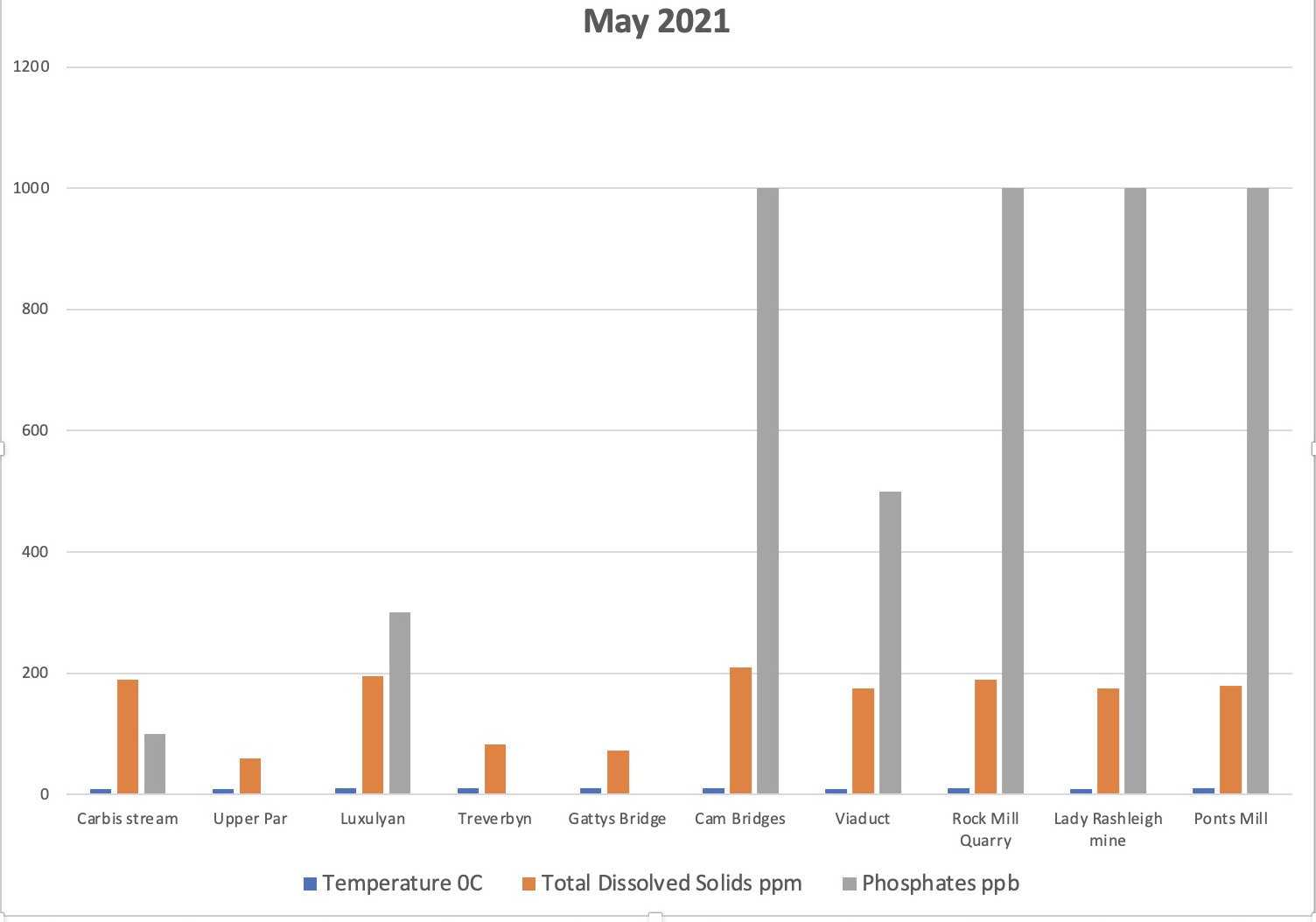
Returning to phosphate levels, a broad picture can be painted. In the Upper Par, near Minorca Lane, the reading as usual was 0, a score of 100 was noted at the Carbis Stream just before its confluence with the main river, rising to 300 at the Luxulyan sewage treatment works. The Treverbyn Stream was 0, so could not be the source of phosphates to the river at the confluence. Likewise, the Charlestown Leat at Bridges was also 0 so could not contributory. A little upstream from the South West Water pumping station on the south side of the village, the level was 1000 while at the outfall it was 2500. About 18 metres downstream from the outfall it was 1000, as it was at Cam Bridges. We do not know the phosphate level at the Viaduct on 14th May because the reading was taken the next day after heavy overnight rain, which may have had a diluting effect. With the exception of the river at the Viaduct (where it was 500 ppb) levels of 1000 were recorded as far downstream as the canal at Middleway.
It is not possible to prove any negative impact on the river from the dilapidated outfall near the South West Water pumping station. The rapid response of the Environment Agency to our concerns about the pumping station outfall is encouraging. Hopefully they will keep an eye on the situation there, if they have the resources. It would be useful to understand the function and efficiency of the pumping station. In the past a major sewage leak has occurred here, but South West Water do not believe it has been discharging sewage into the river recently
Our search for the source of the phosphates goes on!