A Less Leaky Leat (hopefully)
Written by Roger Smith
LESS LEAKY LEAT*
Luxulyan Valley has an abundance of leats spanning many centuries. The only one that still flows (well, just about) is the Fowey Consols leat (HER 9400; SX 0693 5708; Lanlivery parish). Water is taken from the Bokiddick Stream near Gattys Bridge. Originally (from about 1822) the leat flowed all the way to the massive, internationally important (but largely forgotten) Fowey Consols mine at the top of Penpillick Hill. Joseph Austen (later and better known as Treffry) was keen to use water power if possible and this watercourse was his first significant intervention in the Luxulyan Valley. Incredibly, the leat continued to be useful until very recently as it was adapted to generate hydro-electricity at Ponts Mill first by the china clay industry, then as a community run project in partnership with Restormel Council.
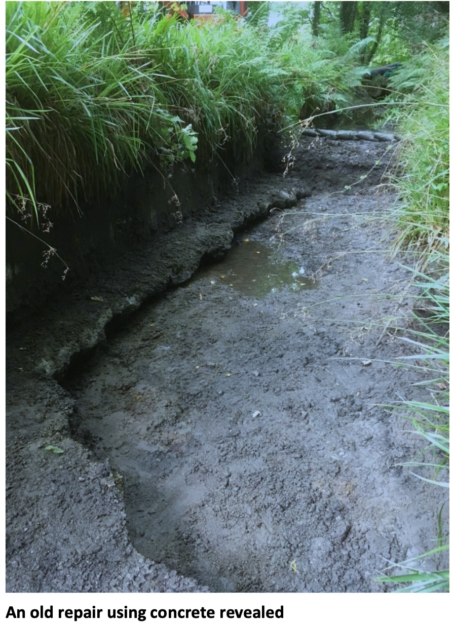
So besides being an historic asset within the World Heritage Site, it has potential to deliver green energy. Unfortunately, it has not functioned properly very recently and no electricity has been produced for some time. To do that, leaks need to be stopped, new fish passes installed and the turbine house revamped – all in all, quite an undertaking. But work has started on making the leat waterproof, as these photos from Jenny Heskett, Cormac Ranger for Luxulyan Valley, show. Over the years various methods of repairing the sides and base have been used, including clay, foam and even concrete.
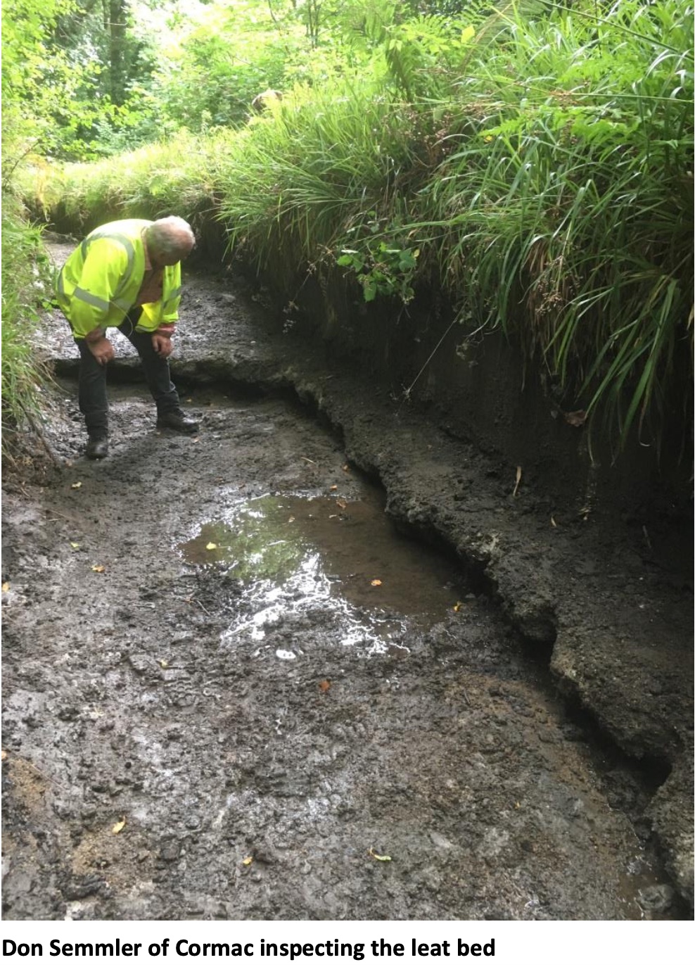
Leats are often thought of as pretty simple features requiring little maintenance but that is not the case. Not only did it take great technical skill to construct them, especially getting the gradient right, but they need frequent, regular attention and a significant investment in materials and manpower. Jenny and her colleague Don Semmler inspect this leat every week, in addition to looking after the rest of the Valley. The leat requires all sorts of care, such as mending leaks, clearing leaves and branches, and dealing with the erosion caused by dogs climbing in and out. But for it to flow properly, this major intervention is essential. It does mean that the leat path is temporarily closed but hopefully it will be worth it in the long run.
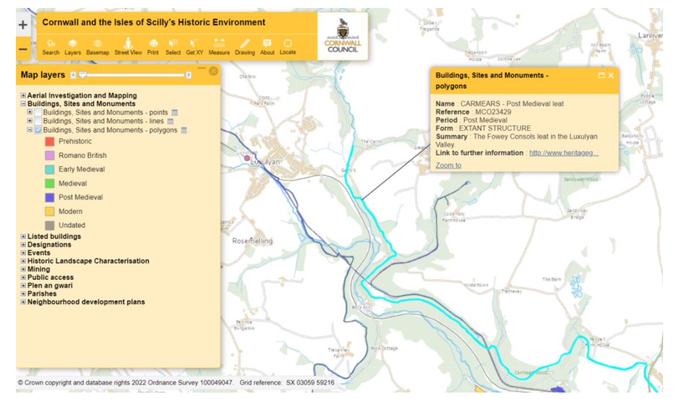
As an aside, some people might wonder how a linear feature like a leat is shown on the online Historic Environment Record map. Lots of features are shown with a dot, colour-coded to show the period of origin, which is linked to Heritage Gateway. But what if the feature is not confined to a specific point? Well, the clever people at Cornwall Council Historic Environment Service have thought of that. If you go to the online mapping at;
https://map.cornwall.gov.uk/website/ccmap/?zoomlevel=1&xcoord=162690&ycoord=64380&wsName=CIOS_historic_environment&layer Name=, select the Buildings, Sites and Monuments layer and click ‘polygons’.
In the case of the Fowey Consols leat, you can see that it is indicated by a polygon: